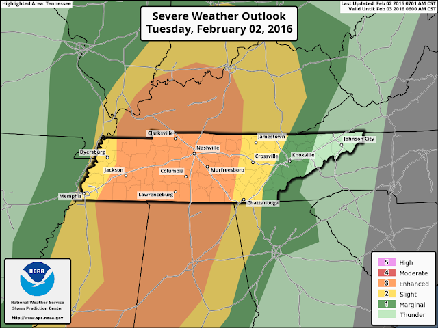
The threat for severe weather in West Tennessee today, February 2nd, 2016 remains at a medium level. The latest forecast from the Storm Prediction Center with the National Weather Service shows a "slight" to "enhanced" risk for severe weather which is basically a level 2 to 3 out of 5.
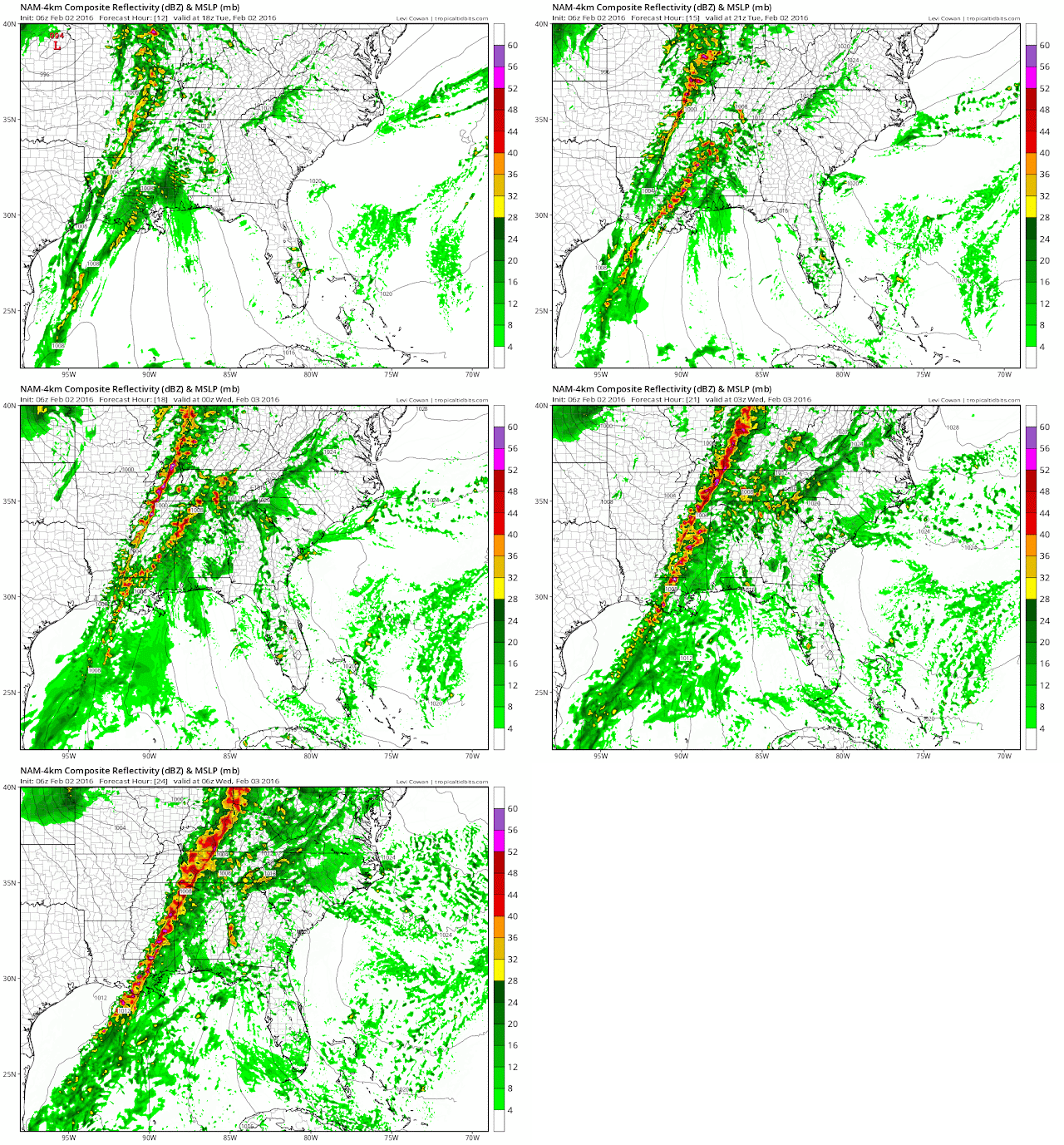
While yesterday, it appeared that the main timeframe for storms would be between the early afternoon and evening (2pm to 8pm), that timeframe appears to be changing. West Tennessee will see scattered showers ahead of the cold front, but the main threat may not arrive until the later afternoon (4 or 5pm) and not leave until the later evening (10 or 11pm). This would keep most of the storms from arriving until after school dismissal.
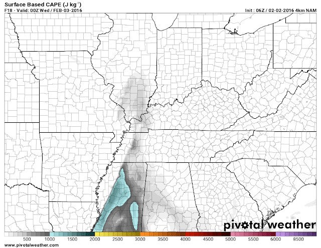
The latest look at how much energy is available is less than it looked yesterday which is normally a good thing, but in the wintertime, the Mid-South typically doesn't need a TON of energy to get things started. I'm trying to stay optimistic with this new information, but threat is still worth taking precautions for.
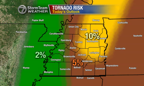
The latest forecast risk for tornadoes in West Tennessee has changed from what the image below shows but not by much. Now, all of West Tennessee has a 5%-10% chance for a tornado to develop within 25 miles of a point anywhere in West Tennessee. To put that in perspective, that risk was at 10% for all of West Tennessee on December 23rd, 2015. Unfortunately, this is starting to look more like the worst case scenario I was talking about yesterday. We'll need to be on guard for a chance for a few tornadoes with a higher chance for damaging winds to take place between the late afternoon and evening.
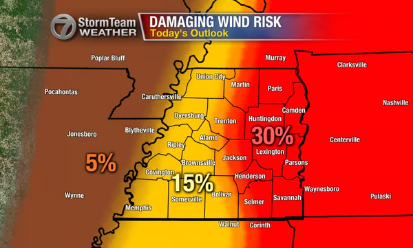
What frustrates me to no end is that we don't have a reliable weather app for our viewers to use today. You can still get alerts pushed to your smartphone on the WBBJ 7 Eyewitness News app but there is not currently a way for you to track the storms on your smartphone through the app.
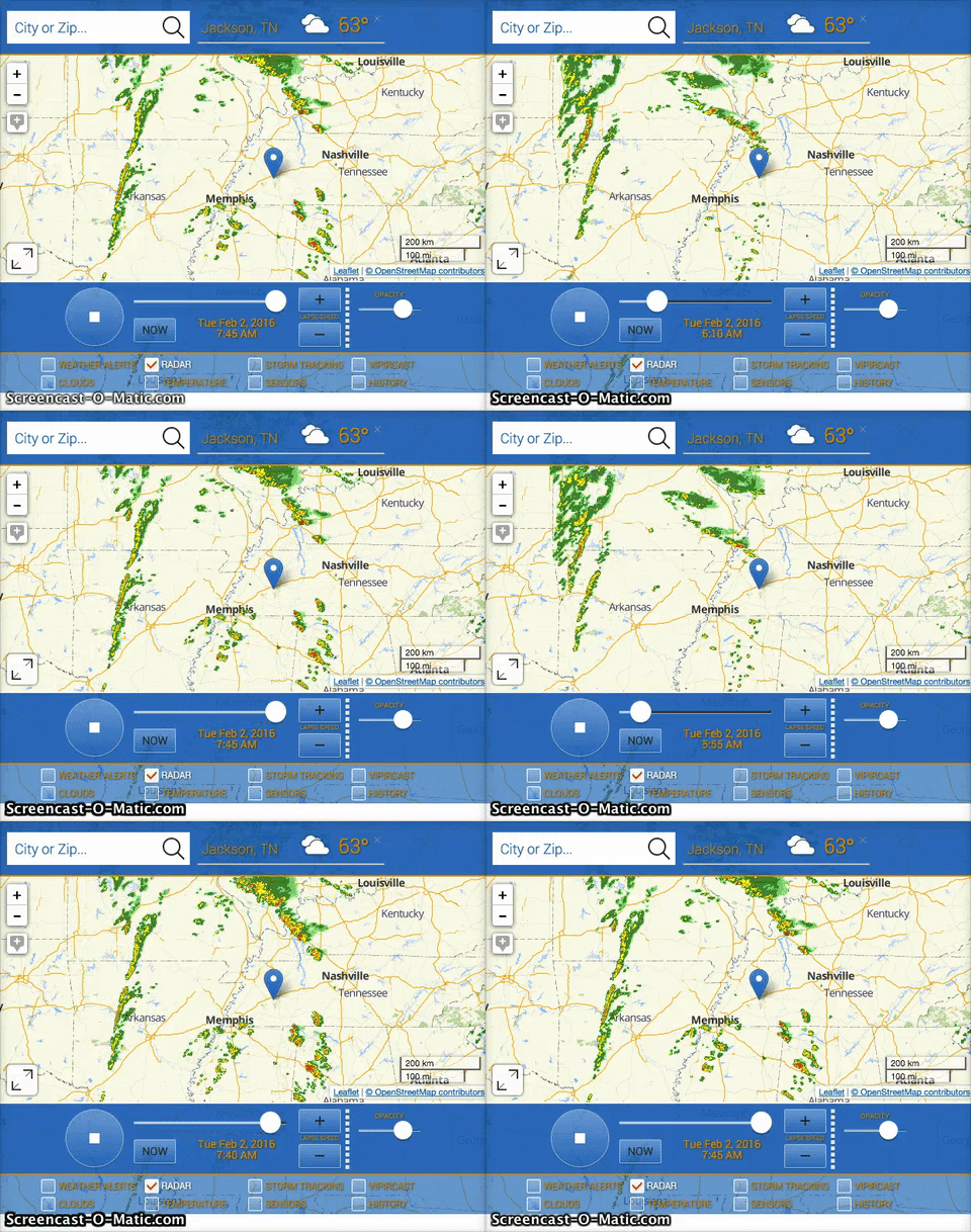
However, our desktop version of the interactive radar DOES work, and it works very well! On your laptop or desktop computer you can go to www.wbbjtv.com/weather/interactive-radar/ and track storms live there.
In summary, here's the QUICK VERSION:
- The timeframe for the main threat for severe storms in West Tennessee is now from late afternoon through late evening (4pm to 10pm or later).
- This would keep most of the storms from arriving until after school dismissal.
- We could get a few showers and possibly a thunderstorm before then to help limit the energy in the atmosphere.
- If there's still a sufficient amount of energy in the atmosphere after that (which is looking more likely) we'll need to be on guard for a few tornadoes and damaging winds this afternoon.
- Tracking storms isn't available on our app but you can use a desktop or laptop computer to do that here.
- Tom
No comments:
Post a Comment