Wednesday, April 27, 2016

Slight Risk for Severe Weather Today, Wednesday, April 27th 2016

NOTE: This blog post is pertaining to a chance for severe weather that is forecast for today, Wednesday, April 27th, 2016.

Regional radar currently shows us the line of storms that moved through the Plains last night, and that it survived the trip across Arkansas now approaching West Tennessee.


A closer look reveals even a few isolated storms in northwest Tennessee early this morning. So far, as of 7:44 a.m. none of these storms or the storms to our west are going severe but we'll be monitoring as that is a small possibility.


However, the latest model data, which you can see below, suggests that as those storms continue to move northeast into West Tennessee, that they weaken and gradually dissipate across our area. This would be round 2 of the storms with a 3rd round of scattered activity during the afternoon and drier weather after sunset tonight.
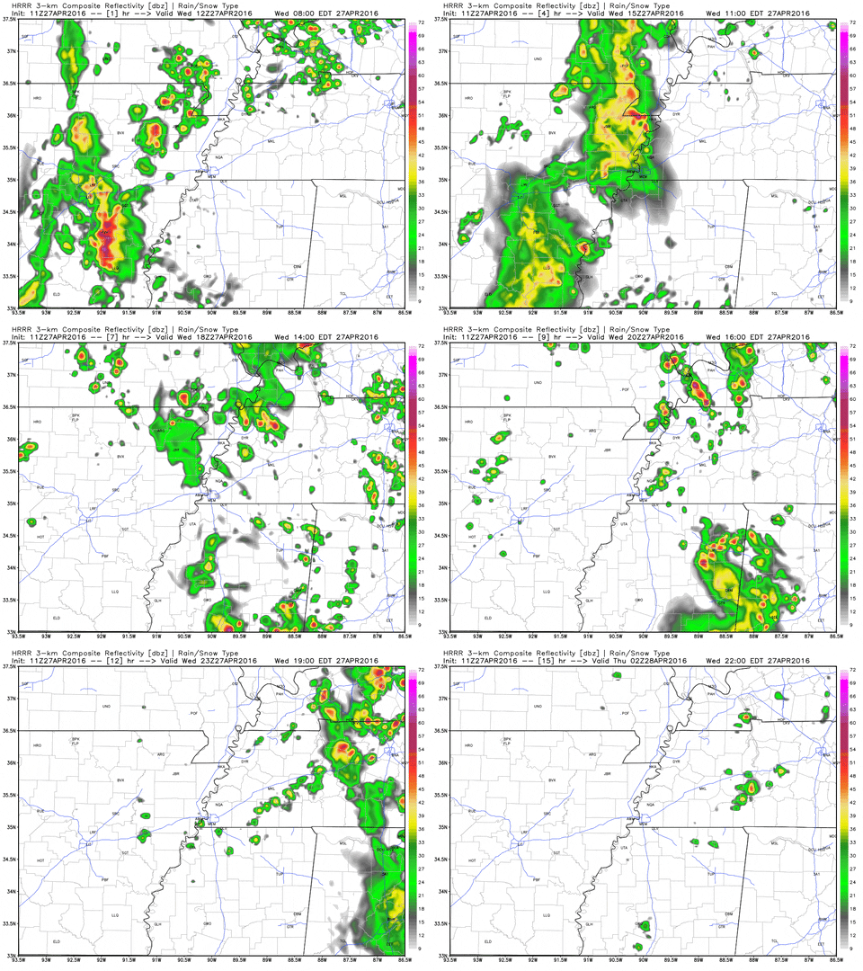

The rain we get from this next wave could help stabilize the atmosphere more for the afternoon preventing us from seeing severe weather, but that's impossible to set in stone. There are still a lot of uncertainties, but overall, our risk for severe weather remains relatively low - a 2 out of 5.


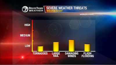
If any thunderstorms DO become severe today, the main threats will be with severe thunderstorms that could produce large hail and damaging winds. The threat for an isolated tornado continues to look very low.


HIGHLIGHTS
  • Rain moving into West Tennessee now may keep our severe weather risk to a minimum today
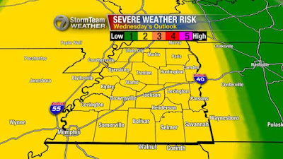
  • Still under a slight risk (2 out of 5) for severe weather across the area
  • Main concern still lies with large hail and damaging winds if any scattered thunderstorms develop during the afternoon

Tuesday, April 26, 2016

Tuesday Afternoon UPDATE: Severe Weather Threat for Wednesday, April 27th, 2016

NOTE: This blog post is pertaining to a chance for severe weather that is forecast for Wednesday, April 27th, 2016.

As of 12:30 p.m. on Tuesday, April 26th, 2016, we've stayed dry so far in West Tennessee but an isolated shower or thunderstorm will be possible this afternoon.

We're monitoring a complex of showers and thunderstorms across Central Missouri that will be moving into northwest Tennessee between 6 p.m. and 8 p.m. tonight (Tuesday).


When they get here, there's a marginal risk (1 out of 5) for severe weather in northwest Tennessee - mainly north of Interstate 40. However, showers and thunderstorms will be possible anywhere in West Tennessee tonight as the line of rain moves southeast across the area. The main threat will be for damaging winds and large hail with this line, but as it approaches Jackson and moves farther southeast, storms are expected to weaken.


On the regional radar image above, you can see that storms have already begun to form out to our west across Oklahoma. That will be the next round of storms to move into West Tennessee, and they're expected to arrive Wednesday morning. Depending on when they get here, they could bring strong to severe thunderstorms in West Tennessee with a risk for damaging winds and large hail. An isolated tornado is possible but that chance remains low.


Again, depending on timing, things could change with those threats. If this line comes in early Wednesday morning. The atmosphere may be able to recover giving us a chance for scattered thunderstorms during Wednesday afternoon and evening resulting in another round of potentially severe weather.

Stay with the VIPIR 7 Storm Team for more updates and stay prepared!

HIGHLIGHTS
  • Isolated thunderstorms this afternoon with a more widespread line of rain and occasional thunder moving into northwest Tennessee between 6pm and 8pm
  • Next wave arrives Wednesday morning with a slight risk for severe weather
  • Potentially looking at another round of storms tomorrow afternoon and evening but won't know more until tonight
  • Main threats are for damaging winds and large hail with each round but an isolated tornado won't be out of the realm of possibility

Monday, April 25, 2016

Severe Weather Threat for Wednesday, April 27th, 2016

NOTE: This blog post is pertaining to a chance for severe weather that is forecast for Wednesday, April 27th, 2016.

Right now, (as of 9:15pm, Monday April 25th) much of the western half of West Tennessee has been placed under a slight risk for severe weather with the rest of West Tennessee under a marginal risk. 


Timing is still difficult to nail down, so we'll have to be prepared for strong to severe thunderstorms during the morning, afternoon, evening, and potentially late at night. We'll be able to get a better handle on when the storms will move in and develop in the area once they start to generate out west tomorrow.

All the ingredients seem to be present to provide us with a risk for strong to severe thunderstorms. Energy seems to be the most available, with a decent amount of moisture and shear. One of the elements found lacking a bit from the environment will be "lift" which may end up being difficult to predict in this situation. Lift is essential to having thunderstorms, or really any rain for that matter. This will also be easier to pinpoint whether that element will be available once the storms begin to develop.


Main concerns will lie with a risk for damaging winds and large hail but an isolated tornado will also be possible, especially during the later hours of the day. Right now, the threats are low to medium, but if the timing of these storms lines up with having more ingredients available, those threats will increase.


We'll keep you updated, but make sure to be prepared for severe weather by having a way to receive weather alerts whether that be with a NOAA Weather Radio, your smartphone, or from someone who can call you with that information.

HIGHLIGHTS
  • There will be a potential for severe weather that may come in more than one round on Wednesday, April 27th, 2016.
  • Timing is still difficult to nail down but we'll know more about these storms tomorrow once they develop well to our west in the Plains.
  • Damaging winds and large hail are the main threats, but an isolated tornado is worth preparing for too.
  • Make sure you have a way to get watches and warnings when they're issued from the National Weather Service!