After about 3 days of talking about the forecast for severe weather this week, today is finally here. On my walk this morning in North Jackson, the sky was already looking ominous and sunshine was peeking through the clouds.
The National Weather Service in Memphis has issued a Special Weather Statement for all of West Tennessee. You can see the text from that report here. Basically, it aligns with what we've been talking about all week.
The Storm Prediction Center with the National Weather Service has continued our moderate risk for today. As seen below, pretty much all of West Tennessee is under that moderate risk. Everyone in West Tennessee should be prepared for possible severe weather today.
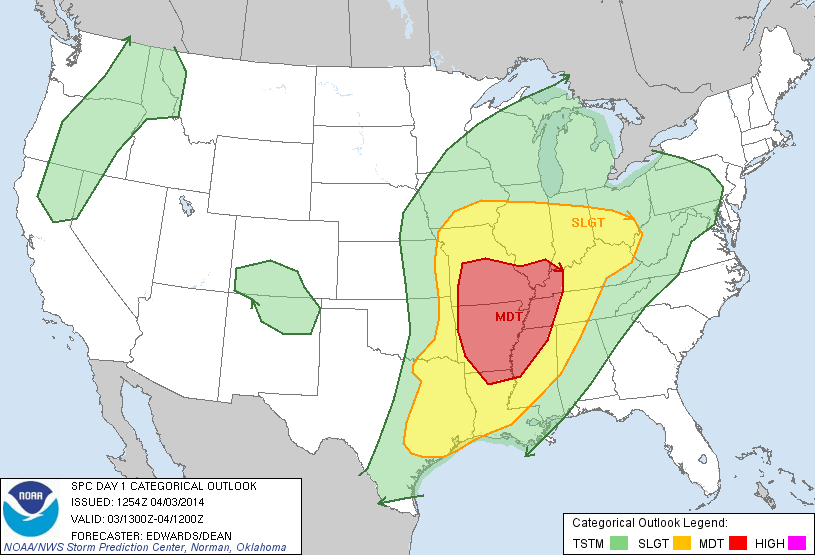 |
| Categorical Risk (West Tennessee - Mainly Moderate) |
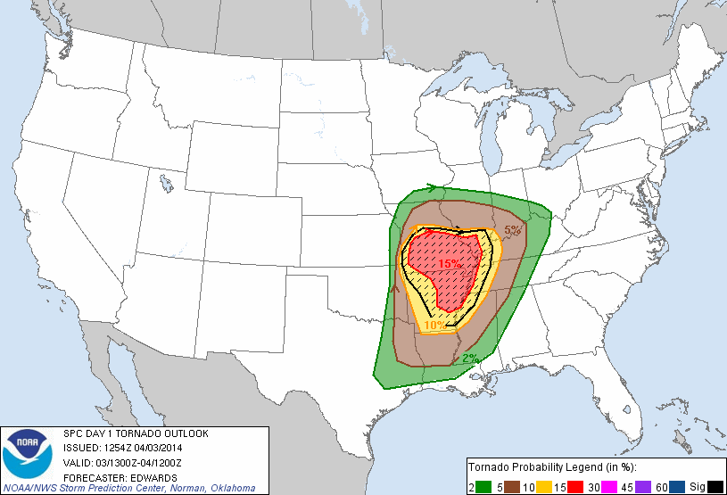 |
| Tornado Probability (West Tennessee - 10%-15%) |
 |
| Large Hail Probability (West Tennessee - 30%) |
 |
| Damaging Wind Probability (West Tennessee - 45%) |
It's worth noting that at this point we have our largest threats from damaging winds and large hail with another added threat for tornadoes and heavy rain that could lead to flash flooding.
At 9:42 a.m. today, thunderstorms were already making their way northeast into West Tennessee out of Memphis.
Storms have the potential to become severe as early on as during the mid afternoon and that threat will continue overnight. However, the main threat for severe weather lies with an oncoming cold front that won't be moving into West Tennessee until after midnight. Here's a look at the forecast precipitation rates for 3 a.m. Friday morning.
 |
| Rainfall rates close to and above 2"/hr in Jackson |
 |
| Wind Speeds upwards of 40mph (those are sustained winds, gusts will be higher) |
Stay tuned to WBBJ and to the Facebook and Twitter accounts of the VIPIR 7 Storm Team for further updates from the National Weather Service throughout the day!


No comments:
Post a Comment