Text Forecast Here
The Categorical Severe Weather Outlook:
(risk for severe weather indicated in yellow)
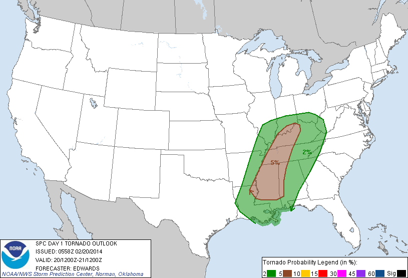
Tornado probabilities:
Wind Probabilities:
Hail Probabilities:
All in all, it still seems worth putting an emphasis on the possibility for an isolated tornado tomorrow, but the main threat remains with a change for damaging winds. Strong winds will be in place before storms even arrive tomorrow, but within potentially severe thunderstorms winds gust upwards of 60 miles per hour. Make sure you're prepared in case of a power outage, and keep your weather radio on!
Another look at the latest forecast from one of the latest computer model runs shows that these storms could arrive as soon as noon in northwest Tennessee and make their way east from there with storms taking place while kids are getting out of school and some folks are just getting off work.


Thanks, Tom!
ReplyDeleteStacy -- McKenzie,TN