West Tennessee continues to get some off-and-on rain this morning with windy conditions. There's plenty more coming. A wind advisory is in effect until 6pm today for all of West Tennessee.

All of West Tennessee is under a slight risk for severe weather today. The main threat is for damaging winds (gusts over 60mph) but hail and an isolated tornado cannot be ruled out.

There is an enhanced risk for severe weather in Northern Mississippi and points south where the possibility for tornadoes is a little higher.

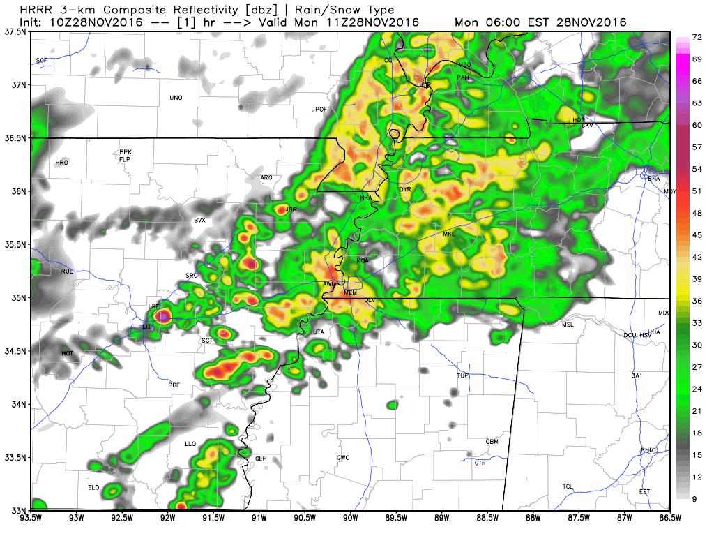
We'll continue to see rain & wind this morning but the strongest storms will be coming this afternoon. Here's a quick look at them in what the radar may show us later today. Notice the dark red line? That's a squall line - a line of strong winds.
Here's a time table for the day. Thinking Jackson will get the worst of it between 3 and 5pm, but especially right around 4 o'clock.

RECAP:
- Severe storms possible after noon.
- Damaging winds will main threat.
- Small possibility for isolated tornado in West Tennessee.
I'll continue to keep you posted on Facebook and Twitter throughout the day!
Facebook: https://www.facebook.com/WBBJ.tom.meiners
Twitter: https://twitter.com/WBBJ7TomMeiners
Facebook: https://www.facebook.com/WBBJ.tom.meiners
Twitter: https://twitter.com/WBBJ7TomMeiners
No comments:
Post a Comment