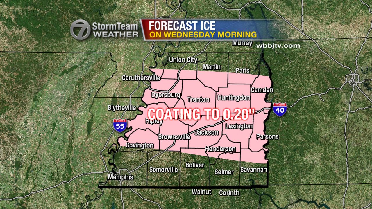
A Winter Weather Advisory has been issued for all 21 counties of West
Tennessee through Wednesday morning. Snow, sleet, and freezing rain are
expected to begin moving in the region before sunrise tomorrow before we
transition to rain and a wintry mix by lunchtime. Travel could be
hazardous in spots and though it won't be impossible, caution is still
strongly advised if you have to go out tomorrow. It's possible that some
schools may close or delay their opening due to the weather.

Tonight,
skies will remain cloudy with temperatures hovering just under freezing
even at the coldest point of the night. After midnight, a snow and
sleet mix will begin moving into northwest Tennessee with the wintry mix
taking over much of the area by 6am. This is going to be a difficult
forecast because we may only see rain with some freezing rain mixed in
near the Tennessee-Mississippi border, but near the Tennessee-Kentucky
border, we may see only snow fall. Every form of winter precipitation is
going to be possible in between.

All things considered, travel could be difficult tomorrow, but not impossible. After noon, above freezing temperatures will lead to any accumulations of snow and ice to start melting. Temperatures will reach the mid to upper 30s and low 40s by the afternoon. We'll get a brief break from the wintry mix before rain returns on Thursday afternoon and evening before changing to all snow on Friday morning. It's possible that we once again have accumulation, but this time mainly from snow, ice does not look as likely this time.

No comments:
Post a Comment