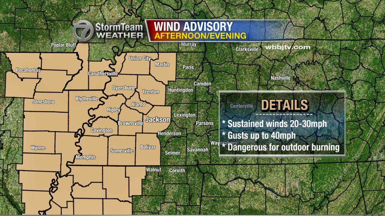
The forecast for today kept getting warmer and now it looks like we could have a good shot at 50°F around lunchtime. However, the warm weather will last very briefly before it gets cold and windy! Sustained wind speeds will peak between 20 and 30 miles per hour this afternoon with gusts up to 40 at times. It's mainly the western half of West Tennessee that will be dealing with the strongest winds which will begin out of the west and shift to be out of the north after a cold front comes through.

That cold front is going to bring dangerously cold air to the region. Sunday morning, wind chills could be in the single digits with readings a few degrees below zero possible too.

This cold air isn't just going to come in feeling frigid, but will also be very dry and THAT is one of the issues that's going to make this forecast so difficult. With drier air, the ratio between inches of liquid equivalent and inches of snow increases exponentially. In West Tennessee, we typically have a 10:1 ratio, which means that for every inch of water that falls, we get 10 inches of snow. However, this time, the snow ratio could be higher than that since the incoming air will be so dry.
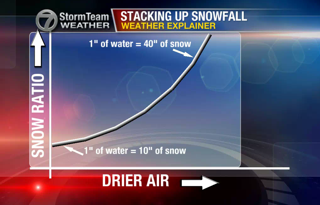
Let's look at that with some actual numbers...
This is our in house computer model's projections for snowfall totals based on a 10:1 (normal) ratio for snow that starts Sunday night and lasts into Monday morning. Most of the values are between a trace and 3". (By the way, this is just a model projection and it has its flaws)

By comparison, this is what the same model's projection looks like based on a 15:1 (drier air) ratio for the same time frame. It's nearly an inch different in some areas! Watching the air move in from the north behind the incoming cold front is going to be key with forecasting snowfall totals.

Right now, we're sticking with a trace to 3" across the area - going with a snowfall ratio that's just a little bit higher than normal. It's worth mentioning at this point, that the reason why we're going lower in southernmost parts of West Tennessee, is because there's a potential for sleet to be mixed in with the snow in those areas. Most parts of West Tennessee should see only snow, but ice could mix in with the snow at first in southwest Tennessee.

It's possible that later today or tomorrow, the National Weather Service will issue winter weather alerts for West Tennessee so make sure you're familiar with the terms below and what they mean.

Winter storm watches are issued well in advance of an event when conditions are possible. On the other hand, advisories and warnings are when the event is imminent - soon to occur or already occurring.
Incidentally, the next week as a whole will be very cold. We may even get another chance for snow on Thursday! There's still some uncertainty in the forecast though, so make sure to watch Good Morning West Tennessee with meteorologist Eddie Holmes for the latest. We'll keep you updated throughout the weekend!
Incidentally, the next week as a whole will be very cold. We may even get another chance for snow on Thursday! There's still some uncertainty in the forecast though, so make sure to watch Good Morning West Tennessee with meteorologist Eddie Holmes for the latest. We'll keep you updated throughout the weekend!


